| About ROSAT |
ROSAT Home Page | ROSAT Images |
|---|


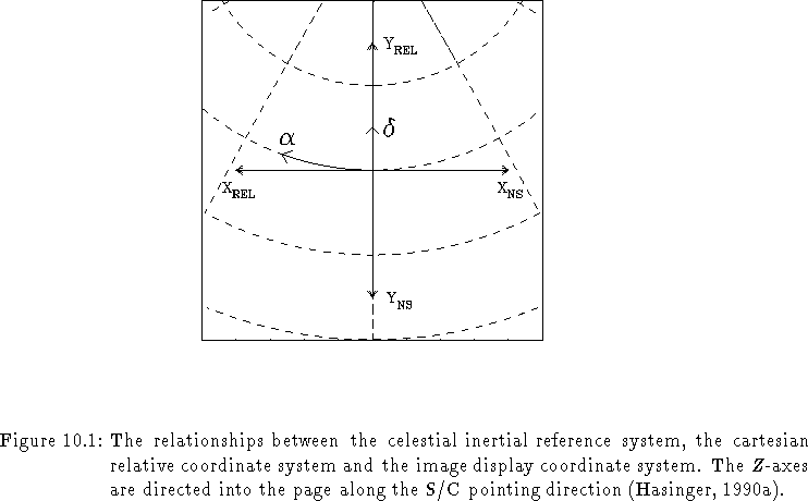
The relative coordinate system is a cartesian frame
( ![]() )
which projects the equatorial frame
(
)
which projects the equatorial frame
( ![]() ) onto the plane FOV.
The
) onto the plane FOV.
The ![]() -axis is aligned with the nominal pointing direction
(or the centre of the strip during the all-sky survey phase),
the
-axis is aligned with the nominal pointing direction
(or the centre of the strip during the all-sky survey phase),
the ![]() -axis parallel to the local meridian
in the direction of increasing
-axis parallel to the local meridian
in the direction of increasing ![]() ,
and the
,
and the ![]() -axis perpendicular to the local meridian
in the direction of increasing
-axis perpendicular to the local meridian
in the direction of increasing ![]() (Fig. 2.7).
(Fig. 2.7).